
Introduction
Old maps of Scotland did not always show counties, they often showed other districts, such as earldoms or provinces. Many of these provinces descended from the seven ancient Pictish earldoms, and others were based on similar divisions and even early versions of the counties.
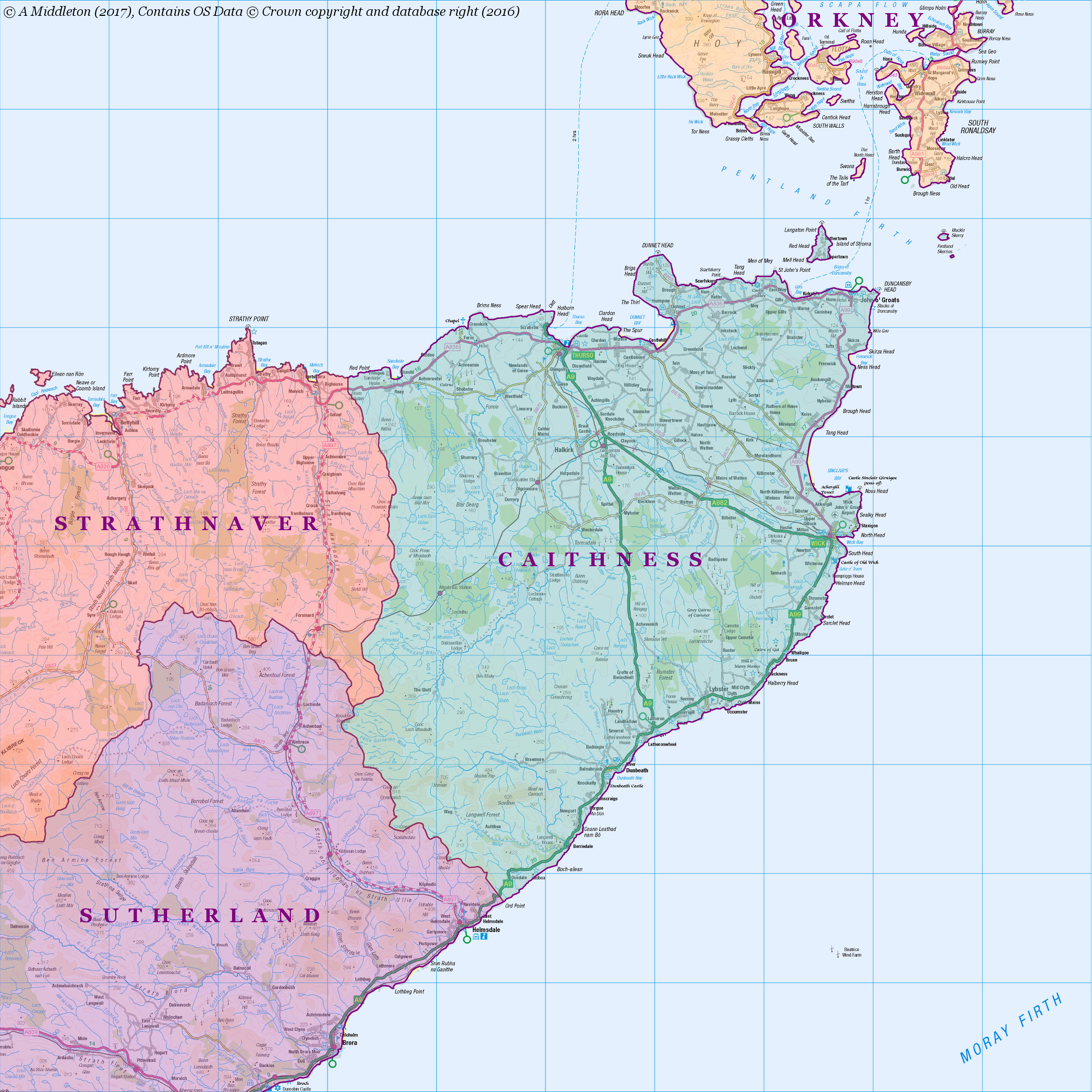
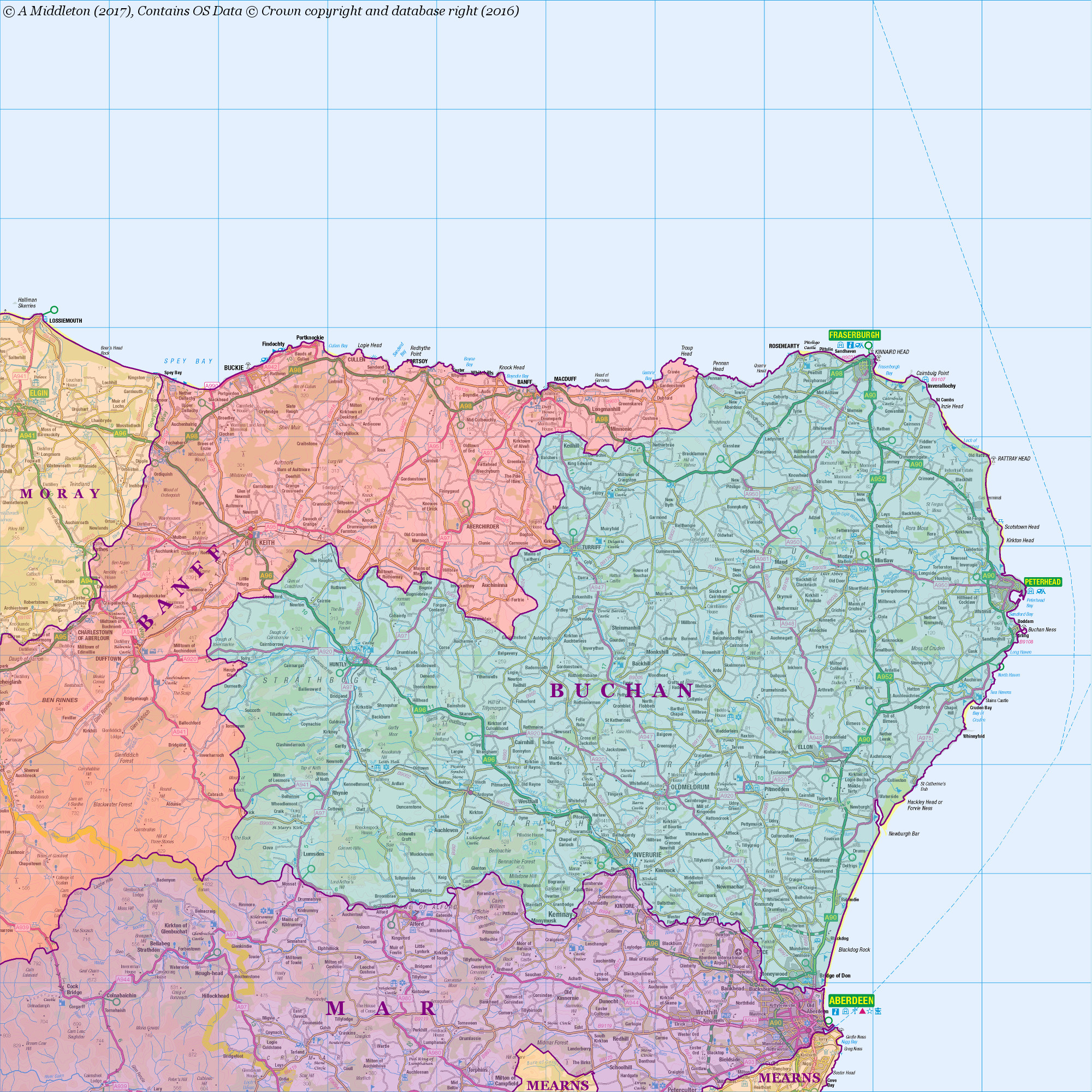
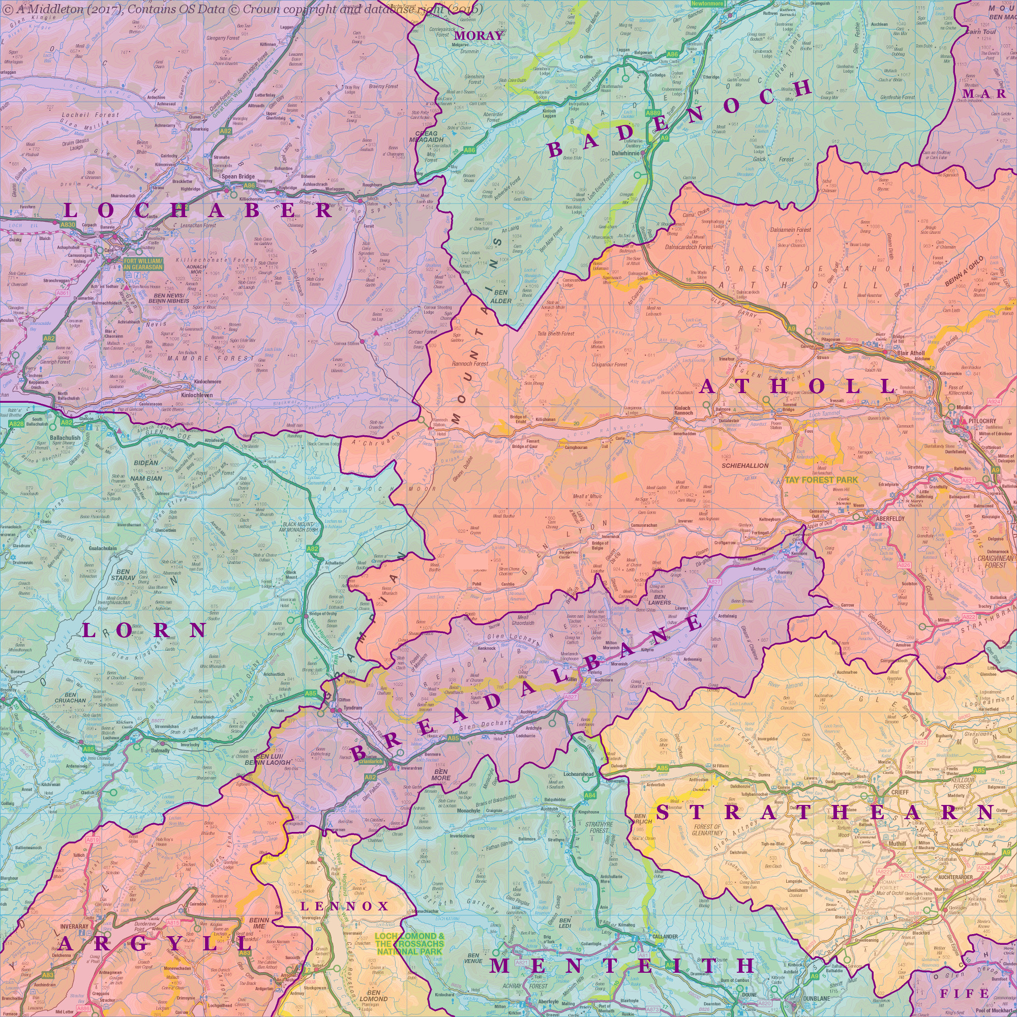
The map below is a modern representation of what the provinces may have looked like. These are based on a number of sources, but mainly “A New Map of Scotland With The Roads by Rob. Greene”, c. 1680, which shows the provinces in colour. Note that in some areas I have employed some guesswork, but the maps depict a general idea of the “pre-county” areas of Scotland.
The map below is an overview with squares indexing more detailed maps of each area. To see these maps, click on the relevant item in the list below the map. I haven’t completed all of the maps yet, so not all of the links are active, but most of them are available at the time of writing.

Contains OS data © Crown copyright and database right (2016)
List of Map Sheets
- Sheet 3 (Western Isles, North)
- Sheet 4 (Strathnaver, Assin, Sutherland)
- Sheet 5 (Strathnaver, Caithness, Sutherland)
- Sheet 6 (Western Isles, South)
- Sheet 7 (Skye, Wester Ross)
- Sheet 8 (Easter Ross, Moray)
- Sheet 9 (Banff, Buchan, Mar)
- Sheet 10 (Mull, Lochaber, Lorn)
- Sheet 11 (Lochaber, Badenoch, Lorn, Atholl, Argyll, Strathearn, Menteith)
- Sheet 12 (Mar, Mearns, Gowrie, Angus, Perth, Fife)
- Sheet 13 (Islay & Jura, Argyll, Bute)
- Sheet 14 (Lennox, Stirling, Lothian, Renfrew, Clydesdale, Cunninghame, Kyle)
- Sheet 15 (Lothian, Tweeddale, The Merse, Teviotdale)
- Sheet 16 (Carrick, Galloway, Nithsdale)
- Sheet 17 (Nithsdale, Annandale)